m |
m (Edited in the new World Map.) |
||
| Line 4: | Line 4: | ||
[[Image:WorldmapDevelopment. | [[Image:WorldmapDevelopment.gif]] | ||
==Elemental Info== | ==Elemental Info== | ||
Revision as of 11:54, 10 February 2007
Outdated template, please use Template:Status Under Construction to mark pages as unfinished.
There will be no more starting over; this is the map. There will be inevitable but minor touchups over the course of development, (edges and other little things, to accommodate details in mapping) but we are close to being ready for more detailed work, based on this schematic. (Not just this single world overview, but closeups of specific regions and locations) Thanks to everyone's hard work and patience, we are finally (albeit gradually) getting back on track.
Elemental Info

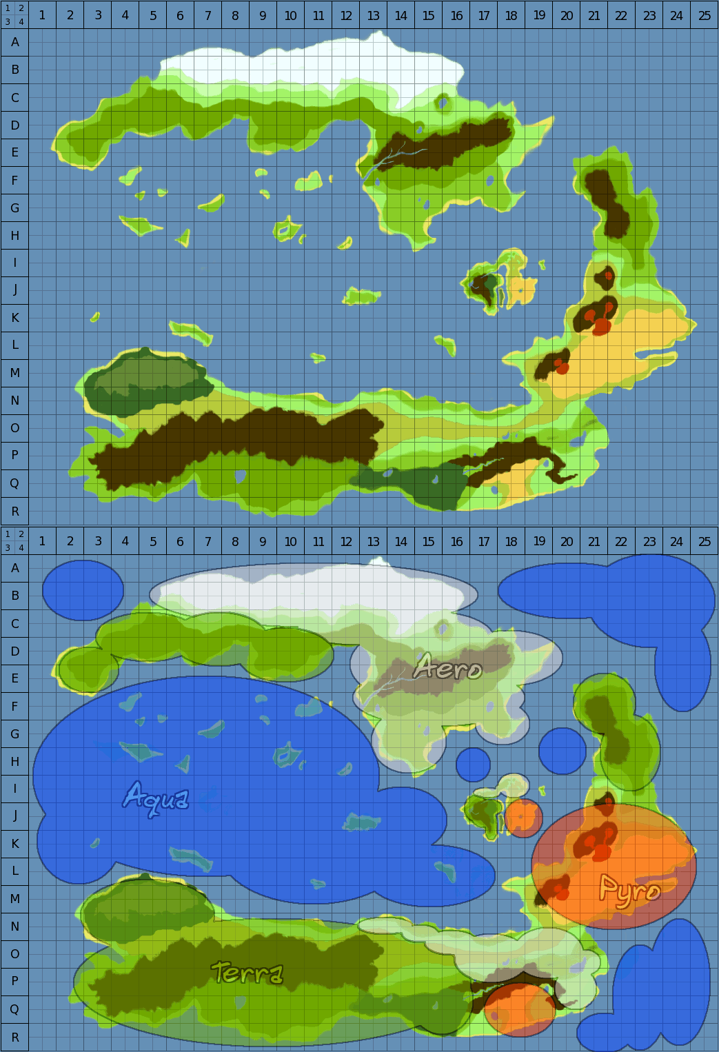
These zones display obvious landscape and terrain characteristics with their relative element.
Each of the four realms circled with red are centers of true elemental energy; each is also home to one of the hidden crystals.
The elemental alignment of these realms are as follows..(starting at the top-left, moving clockwise): WATER, AIR, FIRE, EARTH
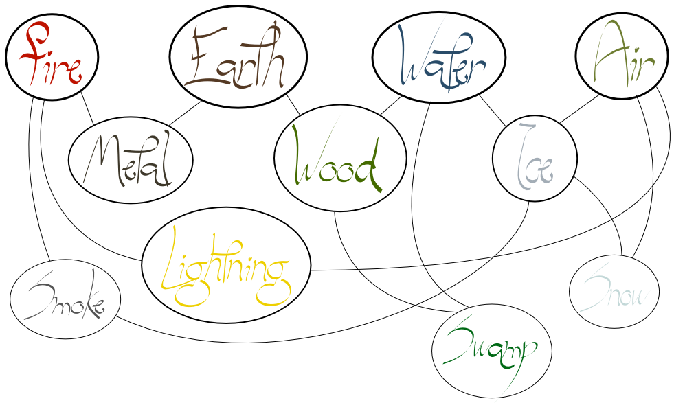
The blue circles are "secondary elements" .. These are not actual elements, but rather products of two combined elements.
They are presented in the same top-left, clockwise fashion: ICE, LIGHTNING, METAL, WOOD
The next set of circles will be "tertiary elements" .. products made of three elements.
So far, the only ideas to undergo any sort of discussion have been: SWAMP, SMOKE, and SNOW (similar but different to ICE).
A fourth level circle will be drawn around the central continent. This is the theoretical level at which Mana energy should be produced, but this has yet to be a proven theory. We can assume that the elemental reaction that most closely resembled "Mana" was the explosive energy expelled after sealing the gods away. Whether this was truley Mana, or an intensely powerful blend of every element, is a very argued topic. Though scholars still don't have many hard-facts about the prehistoric war against the gods, they know enough to develop theories and passionate opinions.
Landforms
We can turn the continents into articles if/when we can apply some good names to the entire landforms. Until then, I'll just list them generically as sub-categories, as per their alignment on the map.
Central Continent
the Xartune woodlands, the Tonori desert
Northern Continent
Eastern Continent
the Volcanic plains of Gehspal
Southern Continent
Kaxna(blue), Eardrass(red)
Western Islands
Epoki Isles(red) [edit: To me some of these isles, look like a face. Two eyes, a nose and a mouth. So i'm going to think of a name for each isle.]
Keshlam, the Floating Continent
Sea
Old World "Stuff"
I'll leave the old world information down here for archival purposes, just temporarily. The maps and regional information before were designed prior to the creation the new backstory and hence forth, do not apply to further development. We will keep them around for as long as they are being used to scavenge names and other material, which currently, they are.
Maps
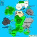
World Map v2005.12.26 by Peacemaker (based on a sketch by Kyokai)
World map by Pickslide.
Worldmap by Pauan
Regions
| Region | Terrain | Key Locations | Description |
|---|---|---|---|
| Sonbrand | Urbanized Island | Great Library | Island of Scholars |
| Frenshya Plains | Plains | A well watered plain between the Kaisei River and the southern seas. Mostly farmland or pastures. | |
| Xartune | Forests, Meadows | Shimris, Macabre, Woodland Village | An overgrown jungle continent to the northwest |
| Gasaro | Grassland, Canyons | A region to the south upon the island of the same name. Gasaro is for a large part empty grasslands, spotted with some canyons and dunes. | |
| Gaeas Hearth | Jungle | At the heart of the world, a dense bastion of mana energy. | |
| Gloriana | Iceworld | A northern continent of snow and ice. Only inhabited by nomads. | |
| Sea of Dissonance | Ocean | A perpetual, powerful ocean current combined with deadly shoals make this northern sea almost intraversable. | |
| Merene Archipelago | Archipelago | A collection of nearly 100 small islands in the southern Sea of Abbana | |
| Motetshi | The last unexplored continent, due to its place beyond a number of harsh shoals and the [Sea of Dissonance]. | ||
| Amplar Deadlands | Wasteland | A large, poisonous muck on the edge of Motetshi. Another deterrent to tourists of the region. | |
| Moori Isthmus | Landbridge | A tiny land bridge that connects Xartune to Tonori. | |
| Sea of Abbana | Ocean | connects to port city of Abanna to the rest of its neighbors via ocean. | |
| OsiruSea | Ocean | A small body of water that separates the island of [Gasaro] from the rest of The Great Continent. | |
| Blachet Sea | Ocean | The sea beneath Aerol, usually a calm one. | |
| Kaisei River | River | A river flowing west from the mountains near [GeonsCrater] to the Sea of Abbana and the Sea of Dissonance | |
| Kaisei River Delta | River Delta | An outlet of the Kaisei River that forms a large marsh. An ancient civilization thrived here which is believed to be a precursor to the civilization at Tulimshar | |
| Gispaa Island | Volcanic island | A small volcanic island, upon which the Temple of Fire sits. | |
| Collis Forest | Forest | A large deciduous forest that separates Shaede from the rest of The Great Continent. | |
| Ivari Sea | Ocean | The sea surrounding Veshrin. Filled with pirates and dangerous storms, due to its proximity with the Sea of Dissonance. | |
| Issa Marsh | Swamp | A marsh at the edge of Collis Forest. Valuable and interesting wildlife thrives there, but the terrain is treacherous. |


